GIGLIO ISLAND ROUTES - QR CODE
GIGLIO ISLAND ROUTES
ROUTE 1
To reach the start of the route, from the bus stop in Giglio Campese, near the sports field, follow Via dell'Allume southwards. The road runs parallel to the Valle dell'Ortana ditch, right on the axis of contact between the limestone and metamorphic area of the Franco promontory and the granite area that characterises the rest of the island. After about 20 minutes, having crossed an area characterised by craft sheds and having passed the forks for paths 309 and 324, we arrive at the junction with path 323, the entrance to path 301, where our route begins. The route is short, however it presents a very steep and in some places exposed staircase. It is therefore necessary to take great care not to lean over the slope and to use suitable footwear. Immediately after the start, the route enters a shady shady holm oak forest. In a short time, you climb up to the ridge from where you overlook the Cala dell'Allume. From here one can observe even better the clear separation between the rocks granite rocks on the left and the limestone and metamorphic ones on the right, which continues into the bay, passing alongside the islet of Cappa. In about 15 minutes you descend on the cliff. At the end of the path it is possible to access the sea at a pretty beach typical of limestone coastlines, consisting of coloured pebbles smoothed pebbles of various sizes, different from the quartz sandy beach of Campese (north-eastern side), originating from the degradation of granite. In this area one finds, in addition to pyrite, modest deposits of alumite, a mineral that was of considerable economic interest in the Middle Ages to the extent that it was traded as currency. On the western side of the cove, a curious cleft in the rock can be seen. For the return trip, follow the same route.
ROUTE 2
The path, although suitable for families, has a walking surface that is not always well levelled and two short steep climbs, so suitable footwear must be used. At the southern end of Campese beach, path 302 is taken from the wharf where the cableway used to load onto ships the pyrite extracted industrially in the Campese mine from 1938 to 1962. At sea, a short distance from the coast, the rusted remains of the pylons are still visible. It This was an important economic activity for the production of sulphuric acid that employed up to 300 people. Our route runs parallel to the coast, touching on the upstream side the holm oak forest that almost entirely covers the Franco promontory, evidence of the original forest typical of the Mediterranean Sea, exploited by man since ancient times for the production of coal. However, the path is protected by fences. After a few minutes, you reach the pretty beach of Pertuso. Ignored the junction with path 324A, which heads southwards, continue along the coast up a short but very steep section, made easier by the presence of a rope handrail. After a short while, we arrive at the overlook of the beach of Cala dei Pozzarelli. The itinerary does not include the demanding descent to the beach (path 302A), but continues in a north-westerly direction. In this section, the shape of the holm oaks growing on the ridge is striking, been able to grow as high as those found elsewhere. Here one must keep to the right and avoid leaning over the sheer coastline. In contact with the holm oak forest, only on the Franco Promontory are the so-called coastal thickets of juniper. In the final part of our path, one can observe some specimens with magnificent twisted trunks. The path ends on the point that offers a spectacular view of the Faraglione, a 23 m high rock pinnacle that rises a short distance from the coast. Another pinnacle is located adjacent to the tip. The panorama around it is stupendous: to the north-east, the west coast of the island, from the Bay of Campese to the Fenaio tip with the lighthouse of the same name; to the west, on a clear day, you can see the clear days, you can see the island of Montecristo. The return is along the same route.
ROUTE 3
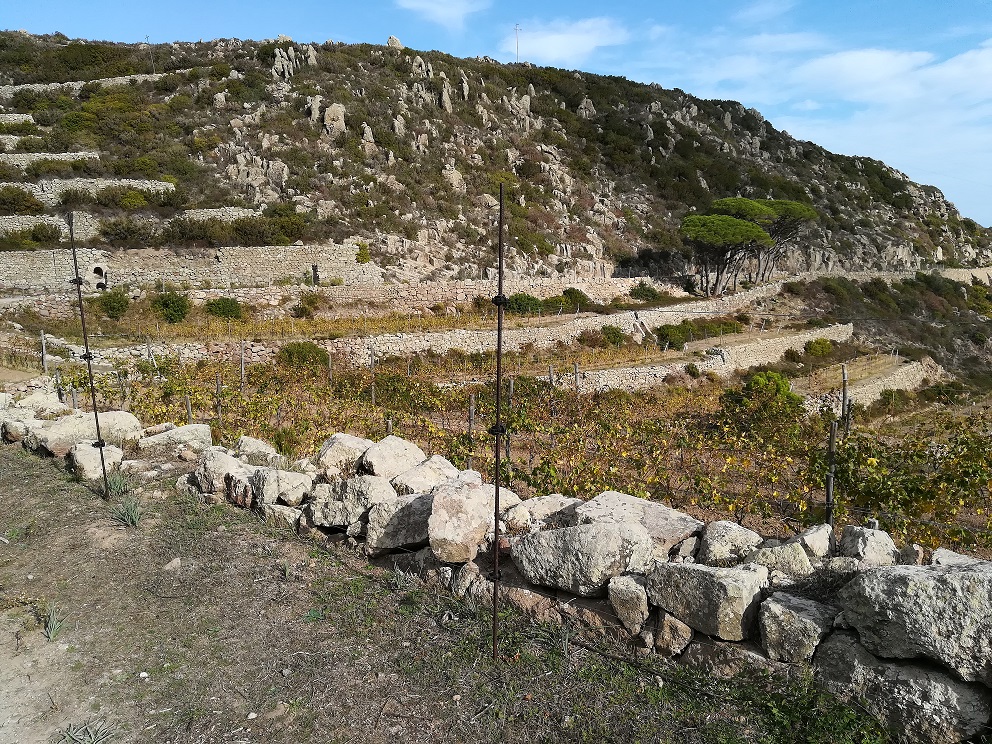
To reach the start of the trail, take the scenic driveway from Giglio Castello heads towards the southern part of the island. Shortly before the asphalt road becomes unpaved, there is path no. 304, which descends towards the coast. In the first part, it goes around a vineyard, crossing the plateau at the foot of Poggio del Serrone, then the track becomes steep. For this reason, although suitable for families, the route must be approached with care, wearing suitable footwear. In spring, the area is dotted with the beautiful yellow blossoms of the thorny broom. The route runs parallel to the steep Pietrabona Valley carpeted with beautiful vineyards, cultivated on terraces. Thanks to the favourable exposure to the sun's rays is particularly suited to wine production, which, given the impossibility access to the land with mechanical means, is carried out entirely by hand. Here Ansonaco, a wine known since antiquity and representative of the island, is produced. Just before reaching the coast, you can see on the left a restored palmento, an artefact once used for wine production, locally called 'capannello'. Immediately afterwards, one passes among large prickly pear plants, an invasive alien species that can compete with typical plant essences and of greater naturalistic interest, limiting their development. These include the Limonium sommieranum, a slender little plant, among the few able to live very close to the sea, an important endemism found only in Giglio, Giannutri and Montecristo, can be found by looking carefully in the clefts between the rocks. This area is one of the few places in Italy where the Corsican seagull, one of the rarest seabirds in the rarest seabird in the Mediterranean Sea, the symbol of the National Park, distinguishable from the herring gull, an abundant and invasive species adapted to human presence, by its coral red beak with a black tip, dark eye, brownish legs and slimmer build. In addition to the diminishing availability of fish, the competition between the two gulls is one of the main causes of the endangered Corsican seagull. At the end of the track, there is no safe access to the sea due to the presence of high rocks. We return back from the same route.
ROUTE 4
From Giglio Castello immediately after the Carabinieri Station, take the road that climbs to the left, with path 303 entering the southern part of the island, heart of the Park, running parallel to the carriageway located further down towards the west. The wide path crosses a pine forest, reaching a plateau at locality of Le Porte where it crosses an asphalt road. After a short while, having left the main road, we turn right onto the steep path 326 that leads to the panoramic Poggio della Pagana (496 metres above sea level), the highest peak on the island, from which you can see the surrounding islands and the Tuscan coastline. You return to path 303 using another path. At the fork, go straight ahead and take path 330A, which, after having past path 307, joins path 330B that crosses the beautiful ridge located between the two Castellucci heights. Having reached path 303 again, our route descends down to Capel Rosso. With a diversion of about 40 minutes you can continue on the route of ridge that bends eastwards to the curious mound of stones of the Poggio del Sasso Ritto and from here retrace your steps. Arriving near the lighthouse, going around it on the right, you reach the splendid granite paved road that descends to the small service landing. In spring you walk among the bright yellow gorse thorny gorse. The trail ends at Punta di Capel Rosso, a spectacular small promontory, squeezed between Cala Saracinesca and Cala Schizzatoio. The area is exposed to the winds, which this is why the vegetation, particularly the mastic trees, form low bushes. Our route involves returning along the same track. Alternatively, you can take path 304 and then the long driveway that in about two hours' walk takes us brings us back to Giglio Castello.
ROUTE 5
From Piazza Gloriosa down a few steps, you reach the beautiful public fountain with adjoining wash-house, and follow Via del Dolce. At the end of the road, keeping right, take path 309 that runs alongside a wall. The path winds its way between ancient drystone walls. Near an olive grove, the path descends more steeply and, immediately just before crossing the ditch, two interesting artefacts can be seen on the right. They are palmenti, small rural constructions called 'capannelli' by the people of Giglio and used for pressing grapes, bearing witness to what for centuries was the island's main economic activity : wine production. The structures contain two vats, often built directly into the granite stone: in the upper one the grapes were placed for pressing, bunches of grapes were placed in the upper one for pressing with the feet, while in the lower one, the must was collected. Arriving at the Valle del Molino ditch, one can observed, in the puddles during the spring period, the tadpoles of the Sardinian discoglosso the only amphibian on the island, an endemic Sardinian species of naturalistic interest, present in Tuscany only at Giglio, Montecristo and Argentario. Once past the ditch you immediately enter a shady holm oak wood. Before man operated systematic the whole island was covered by similar vegetation, a forest of tall holm oaks. Having ignored the junction with path 325, the trail remains flat until the junction with path 323, which is crossed keeping to the right. Having now emerged from the holm oak forest, we begin to descend. Here the panorama opens up over Giglio Campese and the Franco Promontory; in the background the island of Elba, to the west the Corsica. Once in Giglio Campese, take Via dell'Allume to the right, skirting the sports field and, having reached the church of San Rocco, take path 322. After passing a ditch and bypassing a vegetable garden, the ancient granite road climbs among the vineyards. Continue straight ahead at the crossroads with paths 331, 323 and 332 until reaching the provincial road, from which you soon return to the starting point.
ROUTE 6
Start from Piazza Gloriosa in Giglio Castello heading south and take uphill on path 303, which runs parallel to the road below. The wide path immediately enters a pine forest. At the junction with path 333, continue to the right slightly downhill to the plateau at Le Porte, where you cross the asphalted road. It is possible to take a diversion from our route to reach the ridge by continuing straight ahead and taking path 333, which, after passing the junction with path 333B, leads to a panoramic point from where one dominates the Valle di San Giorgio and you can see Giglio Porto. Continue downhill on path 333 until reconnect with path 303 near the locality of Le Porte. A short distance to the left you will find Cote Ciombella, where you can admire some imposing granite boulders of archaeological interest. Path 303, ignoring the forks with 326 and 307, passes to the east of Poggio della Pagana which, at 496 metres above sea level, represents the maximum altitude on the island. After a short while, we reach the junction with path 306, which descends to the left. From here begins the not too steep descent to the coast. The trail is characterised by granite. In some spectacular passages you walk on the bare rock polished by the weather and mottled with an incredible variety of white, grey, black and yellow lichens. The square and skilfully interlocked granite blocks that mark the way. In particular, shortly after the junction, on the right you can see an interesting rectangular granite boulder raised from the ground by the ground by means of four supports, which according to some represents a dolmen. In spring is a riot of colours from the yellow of the spiny broom to the white of the heather and the Cistus salvifolius. The path joins a concrete road that descends steeply down to the junction with path 328, which you take, to the right, near the beach delle Cannelle beach. The road that runs parallel to the coast soon becomes a path. The transparency of the water allows you to appreciate the beauty of the seabed and observe the prairie of Posidonia oceanica, an essential plant for the health of the marine ecosystem. After a while, you arrive at the pretty quartz sand beach of of the Caldane where our route ends. From here, we return on the same path to the Cannelle beach and continuing on the asphalted road, it takes about 1 hour to reach Giglio Porto.
ROUTE 7
It starts from Piazza Gloriosa in Giglio Castello heading southwards. Immediately after the Carabinieri Station you take the road that climbs to the left. Path 303 begins here. The wide path immediately enters the terraces of a pine forest. Ignoring the fork for path 303A, which leads to a viewpoint, and the junction with path 333, continue to the right in a slight descent to the plateau at Le Porte, where you cross the asphalt road. It is possible to make a diversions from our route to reach the ridge by continuing straight on to the second fork and taking path 333. 333B, we go around a building on the Poggio della Mandria dei Bovi (468 metres above sea level) and arrive just before the Poggio della Chiusa (485 metres above sea level) to a viewpoint overlooking the San Giorgio Valley and you can see Giglio Porto. Continue downhill on path 333 until reconnecting with path 303 near the locality of Le Porte. Immediately after the asphalt road, on the left, you can admire some enormous granite boulders. They arethe site of Cote Ciombella which, according to some, is of archaeological interest. Certainly these are majestic natural monuments. Having resumed the path we continue ignoring the forks, both on the right, with path 326 for Poggio della Pagana (496 a.s.l.), highest altitude on the island, and path 307 that leads to the driveway. In this area it is not uncommon to observe rapacious birds of prey that take advantage of the ascending currents to maintain altitude, ready to swoop down if they sight prey. As in the case of the kestrel, which assumes the so-called 'Holy Spirit' position, remaining motionless at altitude in a stall position thanks to small movements of the wing. Among migratory birds one can observe more easily the honey buzzard and the marsh harrier. After a short while, leave the main path to descend left onto path 306 to the Cannelle beach. A few minutes descent and you will turn right onto path 308. The path, shady and cool, enters the into the park, remaining at about the same altitude for a long time with spectacular tunnels of vegetation formed by tall thickets dominated by heather and strawberry trees, a particular type of Mediterranean scrub not widespread on the island. The path, which does not reach the sea, ends near Cala degli Alberi, in correspondence with a private property. The return trip involves walking along same route.
THE ISLAND OF GIGLIO
Entirely made up of granite, except for the small Franco Promontory characterised by sedimentary and metamorphic rocks, the island is purely mountainous; however, there are a few beaches in the bays; has a less steep east coast than the west, where sheer cliffs and high vertical cliffs plunge into the sea. Characteristic of the landscape are the smooth and flat granite formations that appear here and there among the vegetation, both inland and along the coast. From the northwest to the southeast, a mountain a mountainous ridge that has its highest point at Poggio della Pagana (496 a.s.l.). The south-western part of the island lies within the perimeter of the Parco National Park. The vegetation consists of Mediterranean scrub in different stages of evolutionary stages. The holm oak and high scrub with a prevalence of heather and strawberry trees are develop in the cooler and more humid areas. In the south-western part, due aridity, low scrub with cistus and lentisk prevails, or garrigue rich in helichrysum. As far as fauna is concerned, the Sardinian discoglosso, a small frog found only in Giglio, Montecristo, Corsica and Argentario. In addition to being an important stopping point for migratory birds, the island is one of the few places in Italy where the Corsican seagull, an endangered species, still regularly nests. corso, an endangered species. The seabed is rich in biodiversity and the waters are crystal clear.
INFO POINT GIGLIO PORTO
At Giglio Porto, in Via Provinciale 9, there is an information point run in collaboration between the Municipality, the Pro Loco and the Park Authority. At the InfoPoint it is possible to promotional material and book visit activities and organised treks. The structure is enriched by an exhibition space (the "Casa del Park", with entrance on the ground floor) where it is possible to appreciate images of the extraordinary naturalistic and archaeological excellences that characterise the protected area, videos dedicated to the trail network and the International Sanctuary for Marine Mammals "Pelagos", as well as in-depth information on the environments and the cultural values of the islands of Giglio and Giannutri.
THE PATHS
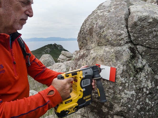
Giglio Island has an extensive network of trails suitable for all types of hiker. For the more experienced walkers, it is possible to walk along the ridge as far as Punta di Capel Rosso, at the southern end, or other ancient communication routes, once used to reach the areas cultivated mainly with vineyards or mining areas. For hikers who prefer to stop by the sea, in the less crowded creeks, there are shorter, albeit steep paths, such as those leading to the Cala dell'Allume or the Pozzarelli creeks. In any case, on these routes it is necessary to pay attention to the bottom, which is not always well levelled. The island of Giannutri also offers the opportunity to enjoy routes of particular landscape and naturalistic interest, which are develop with a flat course and are therefore not very demanding. The paths can be walked all year round. It is always pleasant to walk in the evergreen Mediterranean scrub. The spring period is the most suitable with the explosion of the many-coloured blossoms such as the yellow of the spiny broom or the white and pink of the different species of cistus and heather.
- Do not abandon
- the marked trails Do not light fires
- Do not disturb the fauna
- Do not damage or
- collect plants and flowers Do not abandon litter
- Leashed dogs


