CAPRAIA ISLAND ROUTES - QR CODE
CAPRAIA ISLAND ROUTES
ROUTE 1
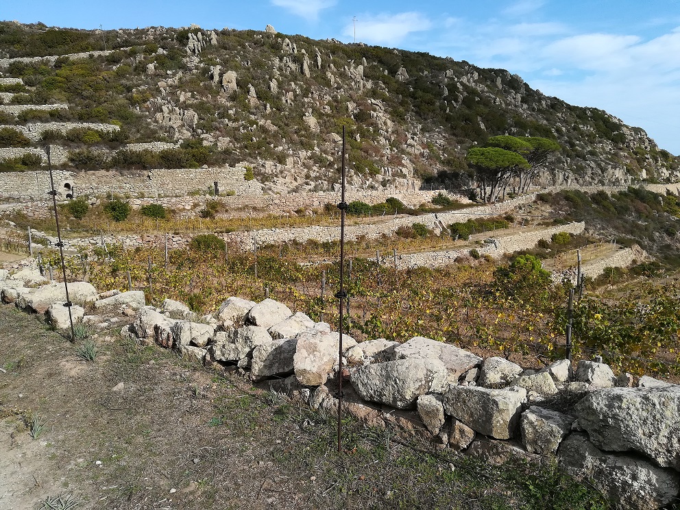
From the Church of Santa Maria Assunta, follow the signs for path 402. At the junction behind the religious building, keep to the right and follow Via del Cornero, which climbs hairpin bends towards the area of the former Agricultural Penal Colony, established in 1873 and decommissioned in 1986. The prison was organised in separate branches with distinct functions, consisting of buildings for the accommodation of inmates and officers and for production activities. After passing through the entrance arch, is the first branch: L'Aghiale. Walk along the main road and at the fork near the old stable warehouse leave path 402, which continues to the left towards the ‘Ovile’ branch, and take path 412 on the right. The path crosses the ‘Portovecchio’ penal branch passing the Agriturismo Valle di Portovecchio and the wine cellar of the Azienda La Piana, first recovery examples of the former prison remarkable building heritage. The dirt road narrows. Pass over the junction with path 412A to the Porto Vecchio cove and keep walking along path 412. The path crosses Vado del Porto Vecchio and reaches the ridge. Pay attention to the fork here: leave path 412, which leads to Monte Capo, and turn left towards path 408. After a few dozen metres is a fork: straight ahead is the penal branch ‘La Mortola’ and ‘Il Dattero’ viewpoint. Our route, along path 408, turns right and goes with panoramic ups and downs to Punta della Teja, the northern tip of the island, where you can admire the ruined Torre delle Barbici overlooking the sea. The tower, commonly known as the Queen's Tower, is the only one with a square base on the island. It was built in 1699 by the Genoese to defend Capraia from enemy raids. The return trail to the port is backward along the same route.
ROUTE 2
From Piazza Milano, take path 406 (a cemented and then unpaved road). After passing a section of elevated mule track, take path 410 ‘del Reganico’, a local word for a rich in water place. The path runs along the small valley of Vado Major. The presence of humidity makes the vegetation particularly lush. Paying attention to the surface, which is slippery in some places slippery in places, we arrive at the small ford crossing the 'vado', Arabian origin word for streams with temporary seasonal character, commonly used in Capraia. The path reachs the fork where you right onto path 410A, a short diversion that descends to Cala dello Zurletto, an enchanting inlet where, with caution, you can access the sea. Going back to the last crossroads and continuing, path 410 goes to the village skirting the heliport. The route is particularly interesting from a botanical point of view, due to the presence of several environments where peculiar species can be observed. The nearby ilex grove of Monte Campanile represents the most evolved vegetation on the island, now almost completely disappeared. The Mediterranean maquis has an abundance of marine cistus, lentisk, myrtle, broom, heather and strawberry tree. In the garrigue is the scent of rosemary, lavender and helichrysum. In spring the asphodels, called ‘zurletti’ by the people of Capraia, bloom. Descending to the cove, you may admire the arboreal euphorbias with their characteristic hemispherical shape. The path is also very interesting for birdwatching activities, to observe the small passerines of the scrub, birds of prey and seabirds. Among the rocks of volcanic origin, it is possible to spot geckos or the green whip snake, the only species of snake on the island. Near the helicopter base are the panoramic terrace of Bellavista, the bathing spot ‘Torretta al Bagno’, and San Giorgio Fort, where you will see some ‘palmenti’, tanks dug into the rock, once used for wine production.
ROUTE 3
From Piazza Milano, beside the Church of San Nicola, take path 406. The cemented road becomes dirt after about 700 m. Ignore the crossroads with paths 410 and 406A, walk on admiring the wide panorama towards the central valley of the island, with the Vado del Porto at the bottom. In summer the ‘vado’ is marked by the pink blossom of wild oleanders. To the west you see the island's ridge and upstate is the area of the former penal colony. At the crossroads with paths 405 and 409, by the place called ‘Il Piano’, path 406 ends. Take path 409 and, after a few dozen metres, turns left in the direction of the Church of Santo Stefano Protomartire. Path 409 goes straight on for about 50 m and then bends right slightly downhill. The path passes next the small Romanesque parish church, hidden in the vegetation of olive trees and shrubs to our left, at a slightly higher level than the walking surface. After visiting the church, important evidence of the plain attendance since ancient times, walk on the route, skirting a few vineyards. Ignoring the junction with path 401 that heads to Piana dello Zenobito, continue to the left on path 409. After a series of ups and downs on uneven ground, the track descends decisively towards the magnificent Cala del Ceppo. Paying attention to the slippery surface in some sections and using the handholds provided to overcome some challenging passages, you will reach the cove, once used as a landing place, bordered to the south by Punta del Patello and to the north by the majestic Punta della CivitataIt. Cala del Ceppo, with beach of smooth rocks and rocky and sandy seabed, is one of the few coves on the island that can be reached on foot. The route back to the village is backward along the same route.
ROUTE 4
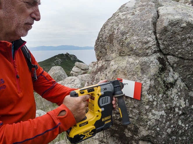
Follow path 406 from Piazza Milano to the crossroads at Il Piano. Turn right on path 405, paying attention to the uneven pavement of the mule track to Monte Arpagna. It rises decidedly. At the end of the steep climb is the junction with path 402, where the path 405 ends. Follow path 404 straight on. Skirting the Monte Pontica and ignoring the junction with trail 413E, you can notice the ruined buildings of the military post. At the junction with path 411, which descends to Punta del Trattoio, the route joins path 403. Straight on uphill and, with a short diversions to the right, you can reach the top of Monte Arpagna. You can enjoy the magnificent panorama and observe the remains of the semaphore post of the Marina Military that controlled the Corsica Channel. Back again on path 403, walk on southwards, descending steeply on dirt track with rock outcrops. Ignoring the crossroads with paths 413W and 413E and the junction with path 401, you arrive to Piana of Zenobito. The path crosses the plain and ends by a viewpoint. From here you can admire a magnificent panorama: the Punta dello Zenobito dominated by the homonymous Genoese tower (16th century), and the wonderfull Cala Rossa, characterised by the incredible contrasting colours of the red and grey-white rocks that plummet towards the emerald green sea. The cove is the result of the particular geological evolution of Capraia. Back to the crossroad, take path 401 which, with several ups and downs due to the morphology, leads towards the village. Pay attention to the horizontal signs, expecially on the rocky outcrops. Ignoring the fork to Cala della Carbicina (path 401A), the path passes the Patello promontory from where you can catch a glimpse of the locality Il Piano, which is reached turning left onto path 409 at the fork. Walk on the path 406 from Il Piano to the village.
ROUTE 5
The route starts from the Park's Environmental Education Centre 'La Salata', built at the former branch where prisoners used to pack fish in salt. A short walk leads to the Church of the Assumption, dating back to the 11th century. Remains from the Roman era have been found in the area, as well as some ancient burials, including one with grave goods, exhibited at the archaeological exhibition 'The Return of the Warrior' in the Church of Sant'Antonio. Behind the religious building turn left at the crossroads towards the freely accessible 'Botanical Path', made by the local production companies 'San Rocco' and 'Arura' with the contribution of the Tuscan Archipelago National Park. Capraia is a true real treasure chest of biodiversity, with numerous endemic species, such as the Capraia cornflower and Linaria, the Capraia goat's curd, the Betonica fetida. The path skirts the ‘Vado del Porto’, where wild Oleanders and Island Mint grow. Along the path small flower beds host characteristic and particular botanical species. The route crosses the bridge over the Vado and runs up along the ancient and suggestive mule track known as 'via romana', irregularly paved. It ends at the Palmento di San Leonardo, a rock-cut basin used in ancient times for wine production. Walking along Via San Leonardo, you arrive in a few minutes to Piazza Milano, where you can visit the Church of San Nicola. Walking along Via Carlo Alberto you get to San Giorgio Fort, built after the destructive assault of the corsair Dragut in 1540. At the base of the fortress are several ‘palmenti’ where you can observe the hollows for the torches.
ROUTE 6
From Piazza Milano, take the road (cemented and then unpaved) that constitutes path 406. At the crossroads at the locality ‘Il Piano’ take path 405 to the right. After a few tens of metres, the walking surface shows the presence of the historic mule track built to get the Navy Traffic Light located on Monte Arpagna. The mule track climbs steeply and it is necessary to pay attention to the uneven and slippery in wet weather. Having passed some shady natural tunnels formed by the high scrub, the mule track flattens out. At the fork situated shortly after the locality of Stagnoli take path 402 to the right. In a few minutes' walk, you arrive at the Sella dell'Acciatore. The short diversion path 402A crosses the asphodel steppe that characterises the saddle and reaches the sheer cliff, from where you can enjoy the view towards Corsica. Walk uphill on the main track 402, you reach the small lake Lo Stagnone, a natural habitat of particular interest and precious resting place for migratory birds. Continuing on path 402 along the eastern shore of the pond, ignore the junction with path 414 and walk along the sea-side slope of Monte Rucitello, towards Monte Le Penne. This particularly spectacular stretch requires attention: the path is narrow and the slope descends steeply towards the sea. A natural terrace is near the summit of Monte Le Penne, few metres off the path, from which you can admire the wide panorama towards the coast and surrounding islands. Walking on along the main route, descending northwards from Monte Le Penne, pay attention to a passage on rock. Path 402 continues up and down the hillside and crosses the dry stone wall that once delimited the area of the Penal Colony. A variant allows to reach the summit of Monte Castello with path 415A and reconnecting with path 402 trough path 415. Beyond the dry stone wall, the trail descends steeply to the La Mursa farm. It is recommended to close the gates allowing passage. From here, path 402 is a dirt road and reaches the nearby ‘Ovile’ penal branch. The penal colony was organised in separate branches, consisting of facilities for prisoners and the officers assigned to them. The path 402 follows the easy main connecting route, passing by the Portovecchio and Aghiale branches and descends in scenic bends to the port.
ROUTE 7
From Piazza Milano, take path 406 which heads south in a gentle uphill. Ignoring the junctions with paths 410 and 406A, you get the central area of the island, characterised by the most extensive flat area of Capraia, called Il Piano. At the crossroads here, take path 405 to the right. Pay attention to the uneven paving of the steep mule track climbing through the high scrub developed on terraces. At the crossroads shortly after the locality of Gli Stagnoli, along a flat stretch of the mule track, take path 402 to the right and arrive to the Sella dell'Acciatore, the most spectacular of the saddles that characterise the island's ridge. The short diversion path 402A reaches the cliff overlooking Cala del Fondo, a perfect place to observe the fast falcons peregrines and other birds of prey while hunting. Walking on along the main path 402, you reach the small lake Lo Stagnone, a site of exceptional naturalistic value. In spring, it is wonderfully covered by the white blossom of the Ranunculus de Baudot, which lives in the archipelago only in Capraia, thanks to the Park's intervention to eradicate invasive floristic species. At the fork along the eastern bank of the lake take path 414, with which the route to the village begins. The trail descends steeply into the wide central valley, originated by the collapse of the island's main volcanic edifices some 7.5 million years ago. At the bottom of the valley is the Vado del Porto, along which you can admire the 'oleander scrub', present in central-northern Italy only in Capraia. Carefully crossed the ford, the path climb till he junction with path 406A. Turns right to reach the dirt road (path 406) by which, on the left, you get to the village.
THE ISLAND OF CAPRAIA
Capraia is the only island of volcanic origin in the Tuscan Archipelago, shaped by the extraordinary geological episodes that have affected it over several million years. Its territory is predominantly mountainous and culminates in Monte Castello at 440 metres above sea level. The western coasts are steep, the eastern and southern ones are more gentle. Capraia's green mantle is represented by medium to low vegetation associations such as garrigue and Mediterranean scrub rich in heather, strawberry tree lentisk and myrtle, with some circumscribed areas of ilex trees. With regard to the fauna, there are wild rabbits, the green whip snake among reptiles and the Sardinian tree frog among amphibians. The presence of resident and migratory avifauna is significant; among the marine species include the tufted plover, the greater shearwater, the lesser shearwater, the now rare Corsican seagull, along with the more common herring gull. Among the most intersting terrestrial species, is the small Corsican bunting, while birds of prey include the kestrel, buzzard and peregrine falcon. In 2021 the osprey has nested in Capraia after almost 100 years of absence of reproductive couples in the archipelago. The seabed is particularly rich in biodiversity. With regard to cetaceans, in the Capraia sea you can observe majestic minke rorquals and the evolutions of bottlenose dolphins and fast dolphins. In 2020 the extremely rare monk seal was spotted again in Capraia's waters. Located at the tourist port area, the Environmental Education Centre provides all the information needed to enjoy the island's poignant beauty. Inside the Centre are exhibition spaces, multimedia installations in virtual reality and interactive applications that allow visitors to relive the geological formation of Capraia, to appreciate the various opportunities for naturalistic knowledge and enjoyment through the hiking network. A specific exhibition is dedicated to the International Marine Mammal Sanctuary "Pelagos" with images of its extraordinary inhabitants and in-depth information on marine fauna. The courtyard houses realistic life-size models of a family of seal monk seal, a bottlenose dolphin, a common dolphin and a stenella. Here you can book excursions with a Park Guide to discover the trails, geological and archaeological treasures and the island's marine protected area.
ADVICE FOR VISITS
Hiking in adverse weather conditions is not recommended; special care must be taken along the 'mule track' that leads from Il Piano to the Stagnoli - path no. 405 - due to the slippery ground in the wetter seasons. Get informations about the difficulty and length of the path you wish to walk, choose the route according to your physical and technical capabilities, wear layered clothing and appropriate footwear with a carved sole. Do not abandon the official paths: you could damage fauna and flora and risk getting hurt. Considering the lack of shading, strenuous hikes are not recommended in summer. In spring and summer equip yourself with adequate protection, such as a hat and sunscreen. No water sources are along the trails: take on an adequate drinking water supply with you. Put the necessary equipment in your backpack, together with a minimum first aid equipment, without exaggerating with weight. By downloading to your smart-phone the free Avenza Maps application and the map of the National Park trails you can always know your exact position even in the absence of a phone signal.
· Do not abandon the marked trails
· Do not light fires
· Do not disturb the fauna
· Do not damage or collect plants and flowers
· Do not abandon litter
· Leashed dogs


